
DJI MAVIC 3 MULTISPECTRAL

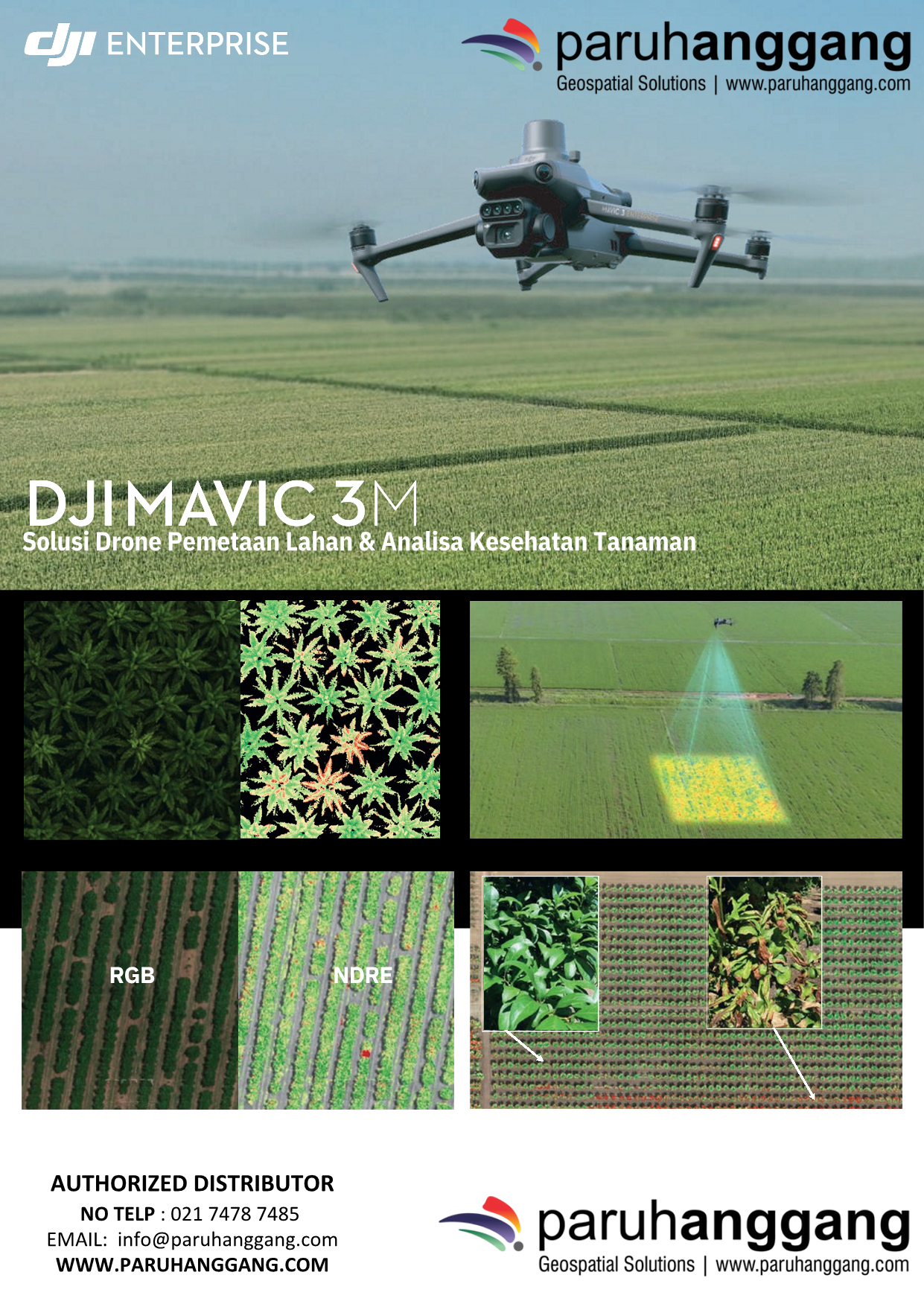
DJI Mavic 3 Multispectral is a compact enterprise drone designed for precision agriculture, environmental monitoring, and vegetation analysis. Equipped with an RGB camera, a multispectral imaging system, and RTK positioning, it delivers accurate aerial data to support smarter and more efficient crop management.

Key Features

  • RGB & Multispectral Imaging – Combines a 20 MP RGB camera with four multispectral sensors (Green, Red, Red Edge, and Near-Infrared).
  • High-Precision RTK – Centimeter-level positioning for accurate mapping and analysis.
  • Long Flight Time – Up to 43 minutes of maximum flight time.
  • Efficient Data Collection – High-speed aerial surveys with excellent image quality.
  • Sunlight Sensor – Automatically compensates for changing light conditions to improve data accuracy.
  • DJI Ecosystem Integration – Compatible with DJI Terra, DJI FlightHub 2, and third-party GIS and agricultural software.

Applications

Ideal for:

  • Precision Agriculture
  • Crop Health Monitoring
  • Vegetation Analysis
  • NDVI & Multispectral Mapping
  • Forestry Management
  • Environmental Monitoring
  • Agricultural Research

Main Benefits

  • Accurate crop health assessment
  • High-efficiency field mapping
  • Reliable multispectral data collection
  • Improved decision-making for precision farming
  • Compact, portable, and easy to deploy

In summary, the DJI Mavic 3 Multispectral is a powerful and portable multispectral drone that combines RGB imaging, advanced spectral analysis, and RTK precision, making it an ideal solution for precision agriculture, environmental monitoring, and vegetation management.
Category:

Description

DJI Mavic 3 Multispectral is a compact enterprise drone designed for precision agriculture, environmental monitoring, and vegetation analysis. Equipped with an RGB camera, a multispectral imaging system, and RTK positioning, it delivers accurate aerial data to support smarter and more efficient crop management.

Key Features

  • RGB & Multispectral Imaging – Combines a 20 MP RGB camera with four multispectral sensors (Green, Red, Red Edge, and Near-Infrared).
  • High-Precision RTK – Centimeter-level positioning for accurate mapping and analysis.
  • Long Flight Time – Up to 43 minutes of maximum flight time.
  • Efficient Data Collection – High-speed aerial surveys with excellent image quality.
  • Sunlight Sensor – Automatically compensates for changing light conditions to improve data accuracy.
  • DJI Ecosystem Integration – Compatible with DJI Terra, DJI FlightHub 2, and third-party GIS and agricultural software.

Applications

Ideal for:

  • Precision Agriculture
  • Crop Health Monitoring
  • Vegetation Analysis
  • NDVI & Multispectral Mapping
  • Forestry Management
  • Environmental Monitoring
  • Agricultural Research

Main Benefits

  • Accurate crop health assessment
  • High-efficiency field mapping
  • Reliable multispectral data collection
  • Improved decision-making for precision farming
  • Compact, portable, and easy to deploy

In summary, the DJI Mavic 3 Multispectral is a powerful and portable multispectral drone that combines RGB imaging, advanced spectral analysis, and RTK precision, making it an ideal solution for precision agriculture, environmental monitoring, and vegetation management.