DJI MATRICE 4E

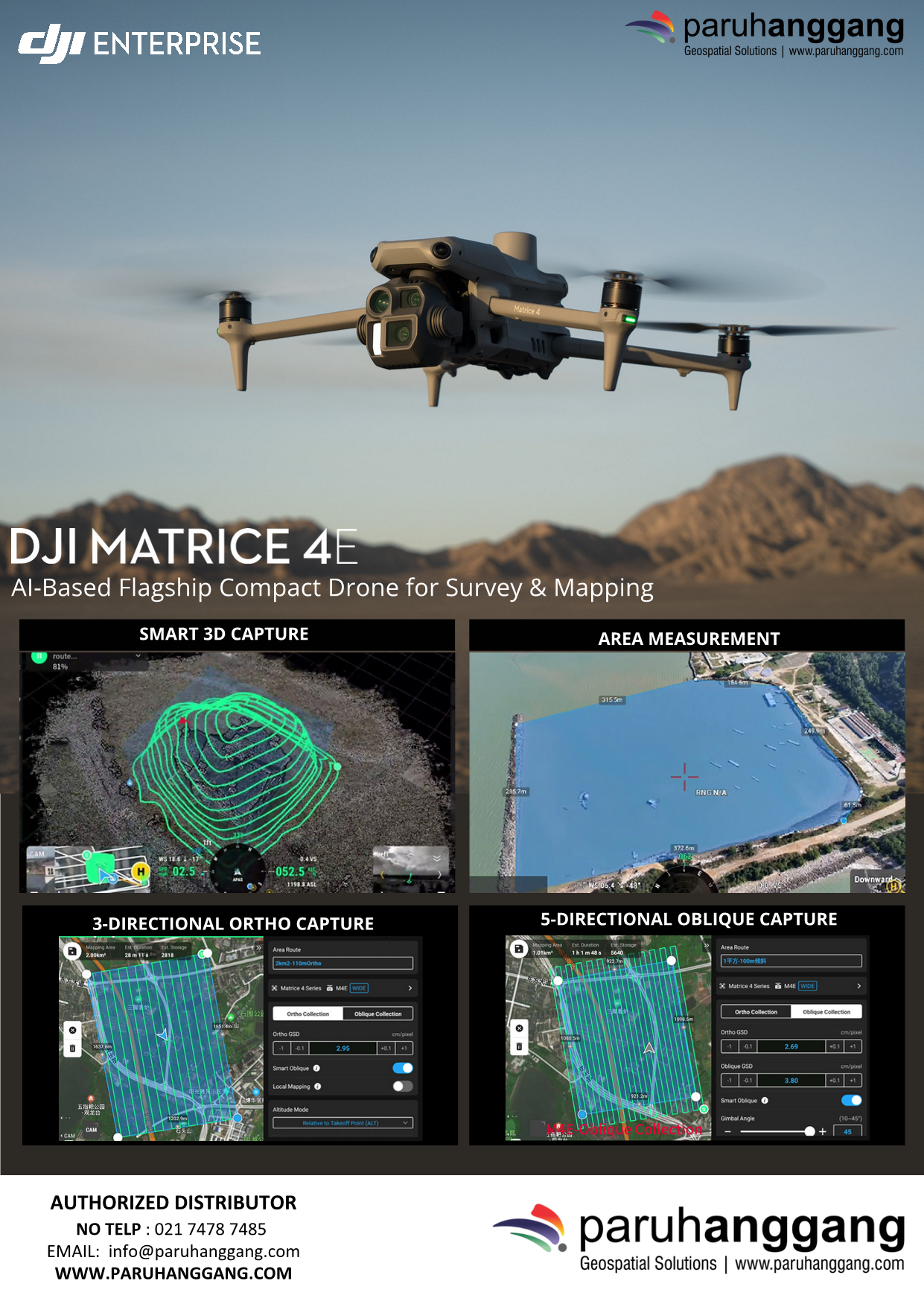
DJI Matrice 4 Enterprise is a compact, intelligent enterprise drone designed for surveying, mapping, inspection, public safety, and infrastructure management. Equipped with advanced AI capabilities, high-precision positioning, and a multi-camera system, it delivers efficient data collection and reliable performance in complex environments.

Key Features

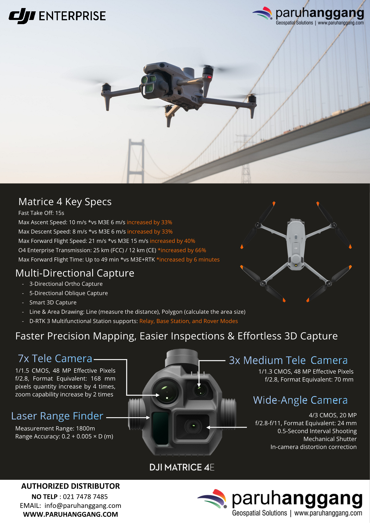
  • Multi-Camera System – Wide, medium telephoto, telephoto, and laser range finder for versatile data capture.
  • AI-Powered Operations – Intelligent object detection, tracking, and automated inspection workflows.
  • High-Precision Mapping – Supports RTK positioning for centimeter-level accuracy.
  • Long Flight Time – Up to 49 minutes of maximum flight time.
  • Advanced Safety – Omnidirectional obstacle sensing for safer autonomous flights.
  • Night Operations – Enhanced low-light imaging for reliable performance in challenging conditions.
  • Seamless Integration – Compatible with DJI FlightHub 2 and DJI Terra for mission planning and data management.

Applications

Ideal for:

  • Surveying & Mapping
  • GIS Data Collection
  • Construction Monitoring
  • Infrastructure Inspection
  • Utilities & Power Line Inspection
  • Mining
  • Public Safety
  • Emergency Response
  • Environmental Monitoring

Main Benefits

  • High-accuracy aerial surveying
  • Faster and more efficient inspections
  • AI-assisted mission execution
  • Reliable performance in complex environments
  • Professional-grade data collection with an easy-to-deploy platform

In summary, the DJI Matrice 4 Enterprise is a powerful, AI-enabled enterprise drone that combines precision mapping, intelligent inspection, and operational efficiency, making it an ideal solution for professional surveying, inspection, and public safety missions.
Category:

Description

DJI Matrice 4 Enterprise is a compact, intelligent enterprise drone designed for surveying, mapping, inspection, public safety, and infrastructure management. Equipped with advanced AI capabilities, high-precision positioning, and a multi-camera system, it delivers efficient data collection and reliable performance in complex environments.

Key Features

  • Multi-Camera System – Wide, medium telephoto, telephoto, and laser range finder for versatile data capture.
  • AI-Powered Operations – Intelligent object detection, tracking, and automated inspection workflows.
  • High-Precision Mapping – Supports RTK positioning for centimeter-level accuracy.
  • Long Flight Time – Up to 49 minutes of maximum flight time.
  • Advanced Safety – Omnidirectional obstacle sensing for safer autonomous flights.
  • Night Operations – Enhanced low-light imaging for reliable performance in challenging conditions.
  • Seamless Integration – Compatible with DJI FlightHub 2 and DJI Terra for mission planning and data management.

Applications

Ideal for:

  • Surveying & Mapping
  • GIS Data Collection
  • Construction Monitoring
  • Infrastructure Inspection
  • Utilities & Power Line Inspection
  • Mining
  • Public Safety
  • Emergency Response
  • Environmental Monitoring

Main Benefits

  • High-accuracy aerial surveying
  • Faster and more efficient inspections
  • AI-assisted mission execution
  • Reliable performance in complex environments
  • Professional-grade data collection with an easy-to-deploy platform

In summary, the DJI Matrice 4 Enterprise is a powerful, AI-enabled enterprise drone that combines precision mapping, intelligent inspection, and operational efficiency, making it an ideal solution for professional surveying, inspection, and public safety missions.